|
Webinar #65 - Thursday, March 21, 2019
Webinar #66 - Thursday, October 3, 2019
Into the wind…Oh, the places mobile radars will go! (Part's one and two)
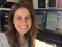
Karen Kosiba
Center for Severe Weather Research
Boulder, CO

(Biography)
The Doppler on Wheels (DOW) mobile radars have been used, often in tandem with other instrumentation, to study tornado formation and structure, the boundary layer of landfalling hurricanes, the internal structure of lake effect snow bands, the gust front structure of potentially severe-wind producing MCSs, and other mesoscale phenomena. Some key findings include the existence of rear-flank downdraft surges, which may impact tornadogenesis, the existence of strong winds in tornadoes very close to the surface, small scale structures that may impact energy distribution and wind speeds in the near surface hurricane boundary layer, and the existence of misovortices in intense lake-effect snow bands. As part of this webinar, Karen will share with you the adventures (and misadventures!) of learning about tornadoes, hurricanes, winter storms, and other high impact weather from over a decade of field work...and discuss what projects are on the horizon.

View the Webinar Part One by clicking here: https://youtu.be/WV8J8M0kIjg
View the Webinar Part Two by clicking here: https://youtu.be/T4THq7OVtTk
View Karen's presentation slides: Part One 
View Karen's presentation slides: Part Two  (coming soon) (coming soon)
Resources:
Center for Severe Weather Research
NOAA's National Hurricane Center
NOAA's Storm Prediction Center
Tropical Tidbits
And for the GIS users in the audience, here is our database of archived NHC Data in GIS Format, including Storm Surge Products: https://www.nhc.noaa.gov/gis/
|