|
What is a Watershed?
A watershed (sometimes called a drainage basin) is an area of land that separate waters flowing to different rivers, basins, or oceans.
To learn more, please view the CoCoRaHS Animation: Watersheds!
How to Use the Watershed Map
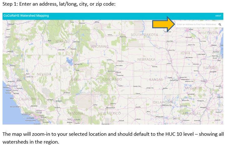
Click here (or on the image below) to open the watershed map tool in a new tab.
What is a HUC?
Similar to zip codes, a Hydrologic Unit Code (HUC) is a sequence of numbers that identifies the location of a watershed, drainage basin or catchment.


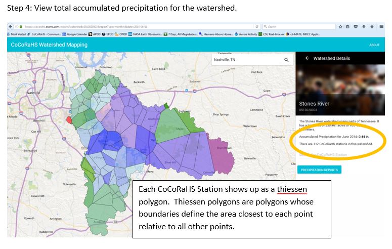
The total accumulated precipitation amount (orange circle) is calculated by adding the totals for each polygon and dividing by the total area, providing an average amount over the entire watershed. The scale at the bottom will indicate the colors ranging from driest (red) to wet (yellow, green, blue, and purple).
Viewing individual station data:

What Next?
-- Use the accumulated precipitation for the entire watershed to calculate the total amount of water that fell (coming soon!).
-- Use the MapMyWatershed model to estimate the runoff and infiltration based on soil the soil type (coming soon!).
|